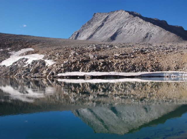
Hiking the Sutter Buttes (North Butte Ascent)

This hike must be guided by the Sutter Buttes Regional Land Trust. The route goes straight up the butte without any real switchbacks – 1200 feet of elevation gain in under three miles round trip, with the most strenuous part 1000 feet up in half a mile.

00

Basics: Access to the Sutter Buttes is extremely limited. Much of the land is comprised of privately owned ranches. The Sutter Buttes Regional Land Trust (formerly the Middle Mountain Foundation) provides guided hikes into the area. This is really the only way for the general public to access the Sutter Buttes. After looking at the scheduled hikes, I naturally picked one of the most difficult ones: the North Butte Summit Ascent.

The hike itself is not actually that long – about 3 miles roundtrip from the parking area to the summit and back. We added an extra mile or two by taking a detour on the way out. It’s difficult because there is no actual trail. The route climbs over 1000-ft at a very steep grade. Despite the short distance, this hike took at least 5 hours. Continue reading “Hiking the Sutter Buttes (North Butte Ascent)”

Four Mile Trail, Sentinel Dome, Panorama Trail, Liberty Cap and Mist Trail… In One Day

In John Muir’s book The Yosemite, there is a chapter near the end entitled “How Best to Spend One’s Yosemite Time”. This post focuses on the first listed single day excursion – the quintessential day hike in Yosemite. It’s about 20 miles total, with about 6,500 feet of elevation gain – longer and more difficult than a round trip up Half Dome.

In the Footsteps of John Muir [Part I]

00

In John Muir’s book The Yosemite, there is a chapter near the end entitled “How Best to Spend One’s Yosemite Time”. The chapter describes several hikes, just as a modern blog would. He describes two single day excursions, two 2-day excursions, a 3-day excursion, and a grand several week excursion (not the JMT). This post focuses on the first listed single day excursion – the quintessential day hike in Yosemite. It’s about 20 miles total, with about 6,500 feet of elevation gain – longer and more difficult than a round trip up Half Dome. Continue reading “Four Mile Trail, Sentinel Dome, Panorama Trail, Liberty Cap and Mist Trail… In One Day”

Ropi Lake via Horsetail Falls – Desolation Wilderness

This hike is 6-ish difficult miles beginning at the Pyramid Creek trailhead on Highway 50, with about 1900 feet of elevation gain. The unmaintained trail goes past Horsetail Falls (a neat destination itself) up to several beautiful lakes in Desolation Wilderness.

00

I’ve been wanting to hike up Pyramid Peak for quite some time, but it just hasn’t happened (yet). On the occasions I have planned to do this hike, I’ve been stopped by major thunderstorms or crazy gusts of wind. This weekend, the weather was looking pretty perfect, but with a late start and the days already getting shorter, we didn’t make it up the peak. I will get there eventually.  Instead, we hiked up to some high alpine lakes and enjoyed a beautiful and relaxing October day in Desolation Wilderness. Continue reading “Ropi Lake via Horsetail Falls – Desolation Wilderness”

Shepherd Pass and Mount Tyndall

34_000

Back in 2010 when we hiked the John Muir Trail, we took a one day detour to the base of Mount Tyndall with hopes of climbing it. In the morning, we scrambled about halfway up the North Rib before deciding to turn back. I think we didn’t climb the mountain for several reasons: we didn’t do any research and weren’t sure of the route, we still had many miles yet to go (with limited food), we had no helmets (the rocks were very loose), and it was freezing cold which gave us a late start on the climb.  Perhaps I’m just making excuses, but it just didn’t seem like a good idea at the time.  Unfortunately, our failure to summit bothered us until we finally decided to return and finish what we started. Continue reading “Shepherd Pass and Mount Tyndall”

Hines Peak from Middle Lion

Basics: Hines Peak from Lion Canyon is about 20 miles round trip.  It’s a long hike, but the views from the top of this peak are epic and worth the crazy hike.  Hines Peak is the highest point in the Topatopa Range.  Do not attempt this hike on a hot summer day – the Los Padres can be brutal.

There are at least four different approaches to climbing Hines Peak. The easiest?  Contact the Forest Service to get the gate code for the dirt road leaving Rose Valley, then drive to the end of Nordhoff Ridge Road (4wd required) and begin the hike from there.  The easy hike is around 7 miles roundtrip.  Alternatively, Hines Peak can be reached from Sisar Canyon (20 miles round trip), Middle Lion (20 miles round trip) , Rose Valley (20 miles round trip), or from the Sespe River trail (multi-day trip).  We opted for the 20 mile hike from Middle Lion Campground.  Sisar Canyon seems to be the most common approach – the Sierra Club HPS page has a pretty good description. Continue reading “Hines Peak from Middle Lion”

Chief Peak from Horn Canyon

Basics: Chief Peak is one of the pointiest summits looming above the Ojai Valley. At 5560 ft, it’s also the fourth tallest mountain in the Topatopa range. The majority of visitors hike this peak from Rose Valley – 9 miles round trip. Alternatively, it’s possible to hike a strenuous 15 miles round trip from Horn Canyon in Ojai. Once atop the narrow summit, you will be rewarded with impressive 360 degree views. This hike is steep, sunny (hot on many days), and uncrowded. Continue reading “Chief Peak from Horn Canyon”

Peak 4864

Peak 4864 is the highest point in the Santa Ynez range (the range of peaks closest to the coast, from northern Ventura County up to Goleta). So naturally, I decided we should climb it. According to Wikipedia, this is one of the few east-west trending mountain ranges in the U.S. – makes sense since the “west coast” for this part of California is really to the South. Continue reading “Peak 4864”

Ape Cave in Washington

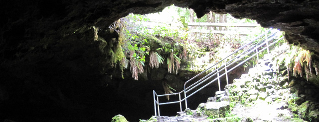
Basics: This is a short hike through a lava tube at Mount Saint Helens in Gifford Pinchot National Forest (Washington state).  The cave is very dark – two light sources per person are recommended.  There’s not terribly much to see, but it’s a unique and interesting experience.  Including the return hike, the trip is under 3 miles.  A parking permit is required and can be purchased at the parking lot.  During the summer, lanterns can be rented at the kiosk near the entrance. Continue reading “Ape Cave in Washington”