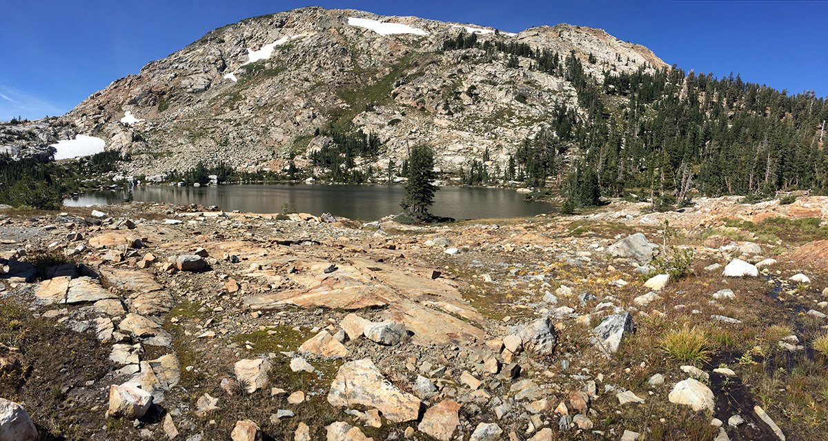
Desolation Wilderness is one of the most heavily used wilderness areas in the country. It can be difficult to find solitude, especially if you’re hiking to Lake Aloha or up Pyramid Peak on a summer weekend. The hike over Rockbound Pass is far less crowded than many of the trails on the eastern side of the wilderness. This 24-mile loop offers some of Desolation’s best scenery with numerous alpine lakes and stunning views of the Crystal Range. Continue reading “Rockbound Pass: Desolation’s Desolate Side”
Tag: lake
Strawberry Mountain Wilderness Loop
On August 21st at about 10 in the morning, the moon cast its shadow across northern Oregon. In the weeks leading up to this solar eclipse, several unfortunate events caused the closure of virtually all designated wilderness areas along the PCT in the path of totality. (The excuse was fire danger, but it was most likely due to the hysteria surrounding the apocalyptic amount of visitors Oregon was predicting for the eclipse.) We had originally planned to be somewhere on the PCT, but in a short amount of time we needed to come up with an alternative. With the help of Google Maps, we randomly settled on the Strawberry Mountain Wilderness. Continue reading “Strawberry Mountain Wilderness Loop”
Carson Pass to Lost Lakes
The area surrounding Carson Pass is beautiful and far less crowded than the neighboring Lake Tahoe basin. This hike follows the Pacific Crest Trail, climbing the ridge under Elephants Back, through the Mokelumne Wilderness and into the heart of Toiyabe National Forest. In late summer, it’s possible to reach the Lost Lakes with an OHV. If you’re on foot, it’s best to visit when snow still covers the dirt road. We planned our hike for July 4th weekend- when Tahoe is overrun with visitors- and we found plenty of solitude. Continue reading “Carson Pass to Lost Lakes”
Mount Agassiz & Mount Price – Desolation Wilderness
Pyramid Peak gets all the attention, but its two sisters in the Crystal Range are definitely worth a visit. Mount Price (9975′) and Mount Agassiz (9967′) can easily be hiked in one day. The Lyons Creek trailhead offers a direct approach to both peaks from the west side. The roundtrip hike is approximately 13 miles with over 3000-ft of elevation gain. Continue reading “Mount Agassiz & Mount Price – Desolation Wilderness”
Emerald Bay Boat-In Campground
Boat-in camping! It is as fun as it sounds! Especially when the campground is located in Tahoe’s beautiful Emerald Bay.
Round Top and Winnemucca Lake
Climbing to the top of Round Top is an interesting hike – it starts of very mellow/easy and gets progressively more difficult as you get closer to the summit. The final 100′ or so are considered an easy Class 3. This hike is located in the Carson Pass Management Area (part of the Mokelumne Wilderness), just south of Highway 88 near Kirkwood Mountain Resort. The beginning of the hike is crowded – many people simply hike up to Winnemucca Lake (a worthy destination in itself) – but far fewer people reach the summit of Round Top. When hiked as a loop, this trip is approximately 6.5 miles with 2000 ft of elevation gain. There are many trail signs; if one knows which general direction to head in, it’s nearly impossible to get lost.
Backpacking Tuolumne Meadows to Yosemite Valley
It’s no surprise Yosemite is one of the most visited National Parks in the country – the place is beautiful. Backpacking is a great way to get away from the crowds of Yosemite Valley. The trails are still more heavily travelled than many others in the Sierras, but the scenery is unbeatable. There are several different ways to get from Tuolumne Meadows to Yosemite Valley. Our route took us over Clouds Rest and up Half Dome. Continue reading “Backpacking Tuolumne Meadows to Yosemite Valley”
Lake Aloha via the Ralston Peak Trail
Shortly after our last failed attempt at backpacking in Desolation Wilderness, I was ready to try again. We waited a few weeks for more snow to melt, then made our reservation for Lake Aloha (Zone 33). We snagged 6 of the allotted 25 spots for this zone.
Basics: This overnight hike was about 13 miles round-trip. This distance sounds easier than it is – the Ralston trail begins by climbing 2400-ft in a few short miles. Anyone looking for an easier approach can access Lake Aloha from the Echo Lakes area. From the route described in this post, it’s possible to take short detours to climb Ralston Peak or visit several other Desolation Wilderness lakes. Continue reading “Lake Aloha via the Ralston Peak Trail”
Lyons Creek Trail – Desolation Wilderness
Things don’t always go according to plan. I’m normally pretty good at planning stuff and I have decent luck most of the time, but every once in a while hiking does not go how I expect.
Continue reading “Lyons Creek Trail – Desolation Wilderness”
Loch Leven Lakes
Basics: Loch Leven Lakes are three very popular alpine lakes in Tahoe National Forest. The lakes are surrounded by granite and typical Sierra scenery. The hike is approximately 8 miles roundtrip. It is slightly shorter if your destination is the first of the three lakes. These lakes offer great swimming and camping – they definitely get crowded on summer weekends! Continue reading “Loch Leven Lakes”