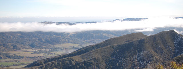
It’s becoming our annual tradition to hike on New Year’s Day. Spending time in the outdoors is a great way to start off a new year. (Though really, when is it not a great time to get outside and hike?) Continue reading “New Year’s Day Hike: Fiske Peak”
Category: Yolo County
Billy’s Hill & Glascock Mountain
This 10 mile hike is located on BLM land, just across the highway from Cache Creek Regional Park. The hike starts off climbing steeply up to Billy’s Hill. If you continue all the way to Glascock Mountain it’s 10 miles and 3100 feet of elevation gain.

Basics: This 10 mile hike is located on BLM land, just across the highway from Cache Creek Regional Park. The hike starts off climbing steeply up to Billy’s Hill. After enjoying the views from there, it’s possible to continue on up two ridges (with a few steep sections) all the way over to Glascock Mountain. There is no official trail, but the path follows a combination of use trails, fire breaks and a somewhat overgrown fire road. Continue reading “Billy’s Hill & Glascock Mountain”
Annie’s Trail
Annie’s trail is a loop that was added to the existing Cold Canyon trail in 2012. Together, the two trails make for a 7.5 mile hike with about 2500 ft elevation gain – a moderately strenuous hike.

Basics: We started the new year off right with a hike along Blue Ridge near Cold Canyon. Annie’s trail is a loop that was added to the existing Cold Canyon trail in 2012. Together, the two trails make for a 7.5 mile, moderately strenuous hike. A highlight of Annie’s Trail is Annie’s Rock – a giant boulder outcropping near the top of the ridge. It’s a great spot for lunch.
The trail is still relatively new – in 2009, Tuleyome and supporters purchased Cold Canyon Headwaters, a 72-acre parcel in the upper watershed above Stebbins Cold Canyon UC Natural Reserve. Tuleyome volunteers built the 2.5 mile loop and named it Annie’s Trail. It is named after late Tuleyome board member Anne Schneider who was instrumental in helping preserve the Cold Canyon Headwaters. Continue reading “Annie’s Trail”
Stebbins Cold Canyon Reserve
Basics: This moderately strenuous 5-mile loop begins in Stebbins Cold Canyon Reserve (a UC Davis Nature Reserve) and climbs up onto an adjacent BLM trail with impressive views of Lake Berryessa. All of this is part of Putah Creek State Wildlife Area comprised of 670 acres of varied terrain just downstream of the Monticello dam, where Cold Creek enters Putah Creek. This is a great year-round hike, but it can be a little brutal in the summer heat. This hike is extremely popular – especially with college students – so if you are looking for solitude, get there early.

Blue Ridge – Fiske Peak Loop Trail

Basics: This 17+ mile loop on BLM land travels along Blue Ridge, then descends and winds through Fiske Creek’s riparian canyon. This trail would be difficult on a hot summer day, but it is a great winter hike with expansive views. Continue reading “Blue Ridge – Fiske Peak Loop Trail”
Fiske Peak

Basics: Sweeping vistas of the Capay Valley, Coastal Ranges, and on a clear day, the Sierras. This hike begins at the Cache Creek Regional Park Lower Site. It is approximately 8 miles roundtrip with an elevation gain of 2300 ft. There is a $6 parking fee – and bring a pen to fill out the little envelope. Dogs on a leash are allowed. Potential hazards include: poison oak, rattlesnakes, and treacherous terrain. Continue reading “Fiske Peak”

