
There is nothing easy about climbing California’s second tallest peak. The approach is long (over 26 miles round trip) and involves climbing nearly 10,000 ft. Some super humans have day hiked this peak. We took three days to do it and it was still quite a challenge.
Red Tape: Shepherd Pass and Mount Williamson are part of Inyo National Forest. Permits are required for overnight trips and can be reserved online at Recreation.gov. There is a quota for this trailhead, but it’s much easier to get a permit here than in the Whitney Zone just to the south.
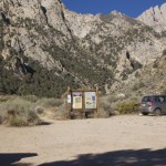
Directions to Trailhead: From Hwy 395 in Independence, turn west on Market Street (aka Onion Valley Road). After 4.3 miles, make a left on Foothill Road. The Shepherd Pass stock trailhead is 2.8 miles down Foothill Road. The hiker trailhead is a couple miles further – continue on Foothill for a half mile then turn right on a smaller dirt road and follow it to the end. There are signs for the trailhead at each junction. All roads beyond Onion Valley Rd are unpaved.
Trail Description:
After successfully reaching the summit of Mt Tyndall last year, I decided climbing Williamson would be a good idea. I reserved a permit for mid-August.
After taking some time off work and loading up the car, we drove down to Independence. We stopped at the White Mountain Ranger Station in Bishop to pick up our permit. Once again, we checked in to the Mount Williamson Motel. We spent the evening packing our bags and eating dinner outside on the patio.

Day 1: Sunday morning we woke early and loaded up the car. We had a breakfast cooked by the gracious motel proprietors- Strider and Doug. Breakfast is eaten at a family style table. We chatted with the other guests: two were ending their JMT hike and two others were finishing the last several days of the JMT (after quitting the trail prematurely the previous year). We talked trails, backpacking and travel while we finished our bacon and eggs. Shortly after, Rob and I hit the road and drove to the Shepherd Pass trailhead.

The forecast for the valley was around a hundred degrees. The temperature was already rising as we started up the trail. In the first mile or two, the trail crosses Symmes Creek four times. Rob soaked his hat and shirt at each crossing. After the final crossing, the trail climbs about 1800-ft, up many switchbacks to the saddle between the Symmes Creek and Shepherd Creek drainages. From there, we descended about 500-ft before climbing again. Many people complain about this drop, but I figure it’s just part of hiking. Sometimes you have to go down in order to go up.
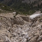
We passed Mahogany Flat, climbed through the giant washout (the trail has not been improved or rebuilt in the past year) and dragged our tired selves into Anvil Camp. We had decided to camp a little higher so after getting some water and taking a long break, we continued up another half mile. We stopped a short distance below the Pothole. We found the perfect campsite: near a creek, near tree line, a good distance away from the trail, and with a spectacular view of the mountains and the Owens Valley. It was worth the extra effort of hiking past Anvil Camp.
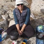
I took a nap on a rock while Rob set up the tent. We cooked, ate, set the alarm and went to bed.
Day 2: Hit the trail at 6:30am! Cold pop tarts were not even remotely appetizing, but I ate them anyway for the energy. We climbed slowly reaching the top of Shepherd Pass sometime around 7:45am. We stopped at the lake and filled our water bottles.

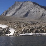
From the top of the pass, the hike to the Williamson Bowl is easy. We ascended a gentle sandy/grassy slope. Williamson came into view and looked as imposing as ever.

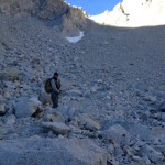
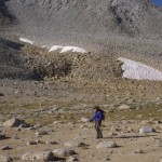
We took a break at the edge of the Bowl. It clearly looked like a boulder hop, but not as terrible as everyone makes it out to be (though little did I know…) Indeed, it only took about an hour to hike across the thing. We made our way towards the black stains on the side of the mountain.

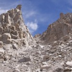
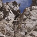
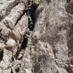
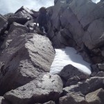
After taking another break below the black stains, we finally began climbing the mountain – mostly up loose scree. This is where the hike truly turns tedious. We slowly made our way past the stains and into the wide chute (up and to the left). Lots of loose rock combined with the high altitude slowed our progress. Cairns marked the way, but we were all alone out there. After a couple hours of slow climbing, we finally reached the chimney! The chimney is considered a Class 3 scramble. None of the moves are very technical, but I would argue it’s a solid Class 4. Nothing is easy at that altitude, and guided groups use ropes for this section. We climbed up through the chimney and were now standing on the summit plateau.

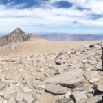
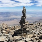
Several false peaks lay between us and the true summit. After 20 or 30 minutes more we were finally on top! It was now past 2:00pm. Definitely a slow pace, but we made it! We had not seen anyone else all day. I thought about how dozens of people were likely simultaneously summiting Whitney, just a short distance to the south. It was nice to have this peak to ourselves.

We spent maybe 30 minutes on the summit, then began the long hike back to camp. I had some trouble down climbing through the chimney, but after a couple twists and turns I found my footing and made it to the bottom. Scrambling down the loose scree was easier than coming up, but it still required a good deal of focus.

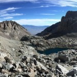
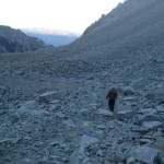
The Williamson Bowl was another matter. It was now 5:00pm and I was feeling pretty worn out. It took us well over an hour to cross through the Bowl. The altitude was starting wear on me. Climbing back up and out was a complete nightmare. It’s maybe only 500-ft vertical, but I barely made it. At one point, I turned around and spotted some campers down near one of the lakes. They were the first humans we had seen all day! They watched us closely as we ascended, perhaps worried by how late in the day it was. This gave me the kick I needed and before long we were out of that desolate (and beautiful) moonscape.
It took a couple more hours to reach our camp. It was all downhill and I began to feel much better as we descended below 12,000-ft. Fortunately, we arrived at our tent about 5 minutes after sunset. We didn’t have to break out the headlamps. Success!! I felt like skipping dinner, but Rob convinced me to eat some mac and cheese. Shortly after, we passed out in the tent.
Day 3: Awoke to another beautiful day in the mountains. We spent a good deal of time cooking breakfast, relaxing, and packing.

We hit the trail around 10:00am and were back at the car by mid-afternoon. We saw two people somewhere around Mahogany Flat: 1 backpacker and 1 trail runner. Both exclaimed “you’re the first people I’ve seen all day!”

We drove to Bishop for the night. After a round of pizza and beer, we soaked our sore legs in the hotel hot tub and began thinking about our next 14er.
More Info: Scaruffi’s page on Williamson was very detailed and helpful in planning this trip.


Way back in 1979, we did it with the same route. I always thought to do it again, but never, even with pay, could I ever find anyone for company! Then, the register book dated to about 1937 or so, but it was taken or lost. I knew a guy who almost did it in a day, but he had to bivvy at the first saddle, by him. No midnight start!
I believe all the Mount Williamson register books (from 1903 through 1989) reside in the Bancroft Library at UC Berkeley. They have a collection of many old Sierra registers. It would be interesting to see some of them.
We went to Bancroft where they had them, and I didn’t see the old Williamson register. Hikers or somebody steal them, and it used to be the local hiking club said by their officers that they all should be “burned.” The Desolation Wilderness management doesn’t allow them, and told me that I’d be arrested for “littering” if I placed anymore. Now, I consider them obsolete, as by video, you can show you were there in posting to the world, as I now do, instead of a signature which can be done below or somewhere and then the book brought back to the summit!
I did Williamson on July 10, 1977 and as I recall the register went book went back into the 1800’s. I saw Norman Clyde’s signature and IIRC Clarence King’s and Cotter.
Awesome photos and story! That “moonscape” is beautiful!
Thanks Emily! 🙂
Thank you for sharing this great post — it has helped me plan my spontaneous trip up Williamson this week. I especially liked your photos. 🙂
Thanks for your comment! I can’t think of a better place for a spontaneous trip. 🙂 Have a great climb!
Great trip report, info and photos. Thanks!
Looking forward to a summit in a few months.
Thanks Ralph. Have a great trip!
We accidentally took someone’s blue nylon bag with glasses, electric shaver, etc from the trailhead container on 5-28-2018. Really sorry and want to return it!! Please comment or email me: ocelo4 at gmail.com
Christa: many thanks for the wonderful report!