
In the Footsteps of John Muir [Part I]
In John Muir’s book The Yosemite, there is a chapter near the end entitled “How Best to Spend One’s Yosemite Time”. The chapter describes several hikes, just as a modern blog would. He describes two single day excursions, two 2-day excursions, a 3-day excursion, and a grand several week excursion (not the JMT). This post focuses on the first listed single day excursion – the quintessential day hike in Yosemite. It’s about 20 miles total, with about 6,500 feet of elevation gain – longer and more difficult than a round trip up Half Dome.
We first attempted this hike several months ago in August. We failed. Even though we made it to the trailhead before sunrise, Christa was carsick (after the drive in from the Wawona Hotel) and it was very hot, humid and buggy. We made another attempt in October – this time we succeeded! Completing this hike requires an early start, a bit of luck, and a lot of determination. The following text is John Muir’s description (in its entirety) annotated with my comments and photos.
“If I were so time poor as to have only one day to spend in Yosemite I should start at daybreak, say at three o clock in midsummer, with a pocketful of any sort of dry breakfast stuff, for Glacier Point, Sentinel Dome, the head of Illilouette Fall, Nevada Fall, the top of Liberty Cap, Vernal Fall, and the wild boulder choked River Canõn.”
Wow. All day with just a pocket full of dry breakfast stuff? We’re going to need a little more food than that. Also, on the longest day of the year, sunrise or “daybreak” is at 5:35am. So 3:00am would be a bit before daybreak in my book. Nonetheless, we began our hike at 5:50am in October – about an hour and a half before sunrise, just as Muir is suggesting.

For the record, we ate all of the following on our hike: three dried fruit leathers, two bagel sandwiches, two cans of Hop ‘Ottin IPA, one Superfood ProBar, half a pound of dark chocolate covered pretzels, a handful of coffee almonds, and one package of ProBar Bolt energy chews (they taste like gummy bears). Additionally, before we left in the morning, we each ate a bagel with cream cheese and drank a Starbucks Doubleshot®. A little more than a pocket full of dry breakfast stuff.
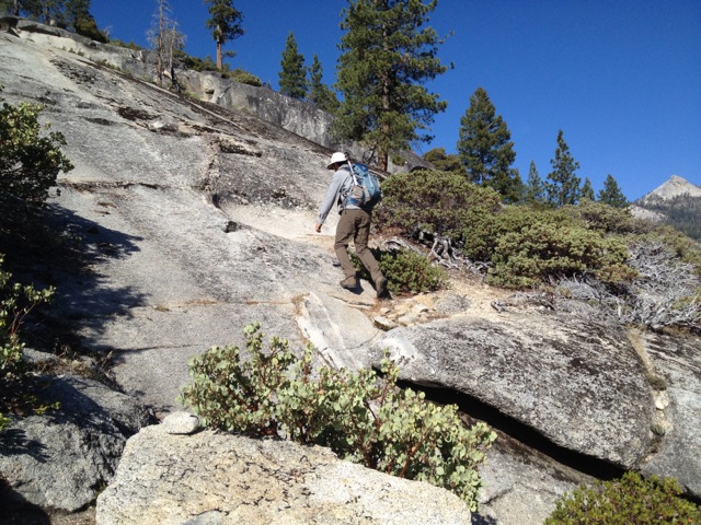
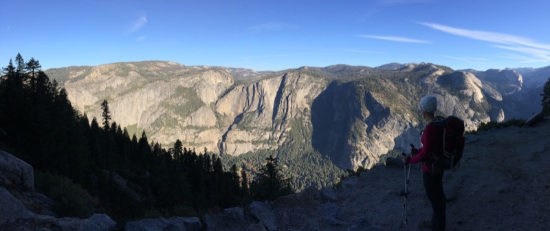
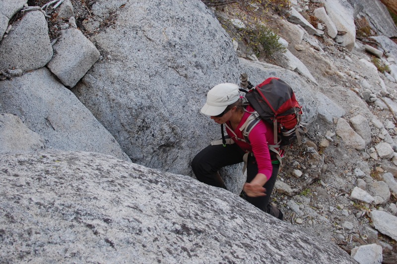
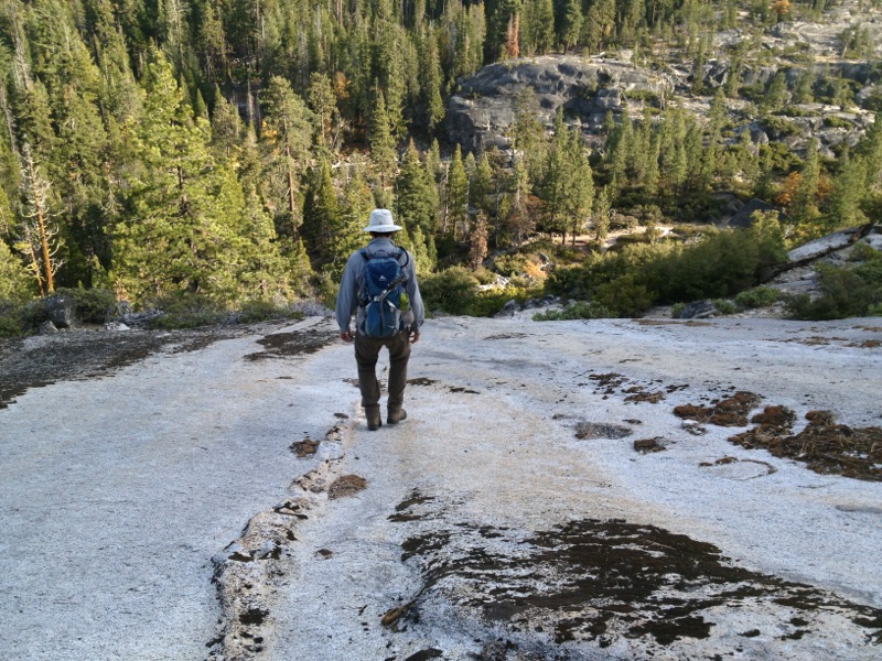
We are not used to hiking with headlamps. Christa kept blinding me with her light. I considered hiking with just the light of the moon and stars, but it was pretty dark around our feet. The lights kept us from tripping over the uneven trail surface. Despite the blinding headlamps, El Capitan and other valley features were impressive in the half-moon light. We heard owls hooting, but otherwise the valley was silent. It actually spooked me a bit – I expected to see the eyes of an unidentified animal (bear) shining back at me, but all was quiet this morning. We got a little lost between the Lodge and the Four Mile Trail, but we managed to find the trailhead in the dark.
“The trail leaves the Valley at the base of the Sentinel Rock, and as you slowly saunter from point to point along its many accommodating zigzags nearly all the Valley rocks and falls are seen in striking, ever changing combinations. At an elevation of about five hundred feet a particularly fine, wide sweeping view down the Valley is obtained, past the sheer face of the Sentinel and between the Cathedral Rocks and El Capitan.”
“At a height of about 1500 feet the great Half Dome comes full in sight, overshadowing every other feature of the Valley to the eastward.”
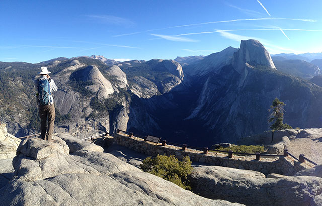
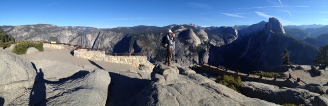
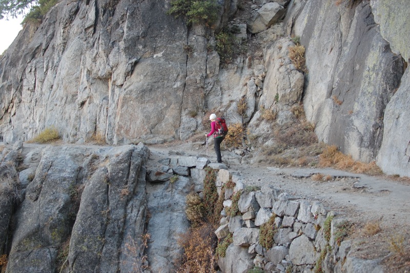
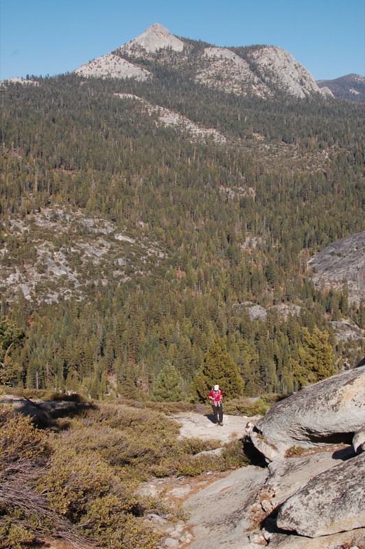
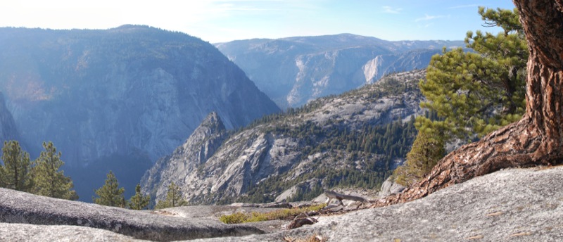
The view from the Four Mile Trail is epic. If you have a decent set of legs and you’re in Yosemite, I advise you to hike up to Glacier Point and Sentinal Dome via the Four Mile Trail.
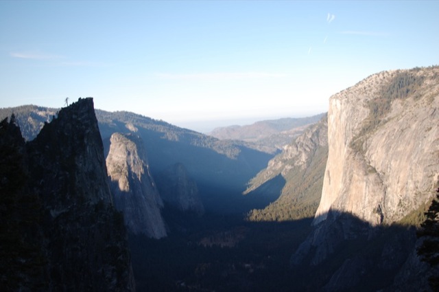
“From Glacier Point you look down 3000 feet over the edge of its sheer face to the meadows and groves and innumerable yellow pine spires, with the meandering river sparkling and spangling through the midst of them. Across the Valley a great telling view is presented of the Royal Arches, North Dome, Indian Canõn, Three Brothers, and El Capitan, with the dome paved basin of Yosemite Creek and Mount Hoffman in the background. To the eastward, the Half Dome close beside you looking higher and more wonderful than ever; southeastward the Starr King, girdled with silver firs, and the spacious garden like basin of the Illilouette and its deeply sculptured fountain-peaks called “The Merced Group”; and beyond all, marshaled along the eastern horizon, the icy summits on the axis of the Range and broad swaths of forests growing on ancient moraines while the Nevada, Vernal, and Yosemite Falls are not only full in sight but are distinctly heard as if one were standing beside them in their spray.”
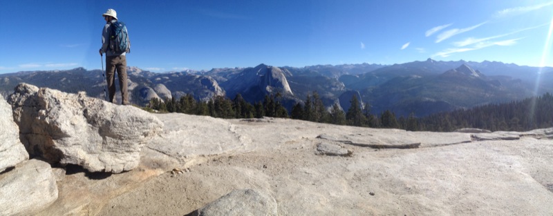
We reached Glacier Point at about 9:00am. Our timing was perfect. The morning light was incredible, plus the first shuttle from Yosemite Valley had not yet reached the summit. We enjoyed a peaceful few minutes with absolutely no other people at Glacier Point. We didn’t stay long because we knew there was an even better vantage point ahead of us…
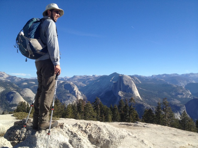
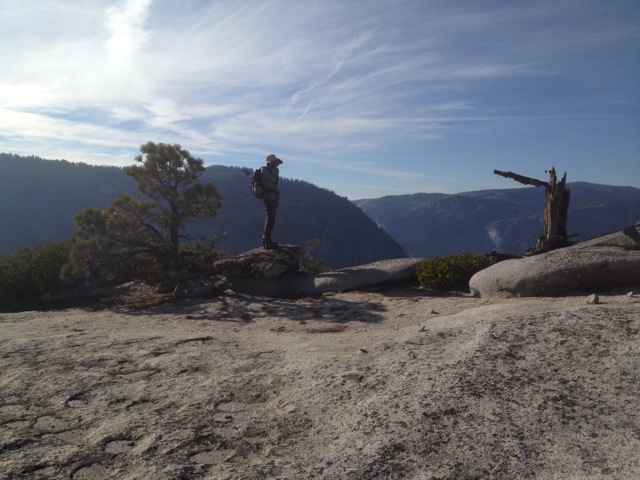
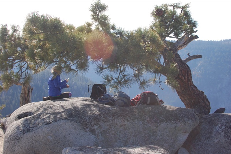
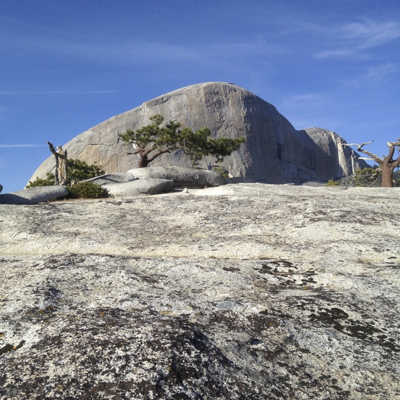
“The views from the summit of Sentinel Dome are still more extensive and telling. Eastward the crowds of peaks at the head of the Merced, Tuolumne and San Joaquin Rivers are presented in bewildering array; westward, the vast forests, yellow foothills and the broad San Joaquin plains and the Coast Ranges hazy and dim in the distance.”
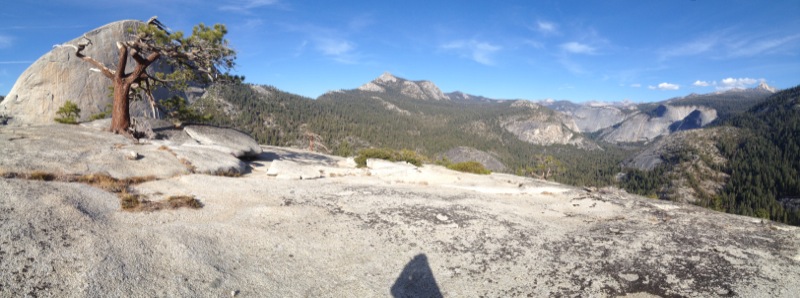
I’m not sure how long it’s been since one could see across the San Joaquin Valley. On this otherwise clear October day, the Valley seems present in the form of a greyish brown haze. It must have been something truly amazing to see from the Sierras to the Coast Range. That said, the views from Sentinel Dome are worth every step of the extra mile and a half from Glacier Point. The famous Ansel Adams tree photograph was taken here, though unfortunately the tree is no longer standing. We ate a bunch of chocolate covered pretzels, then continued down the trail. Many miles to go.
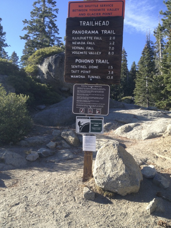
“From Glacier Point go down the trail into the lower end of the Illilouette basin, cross Illilouette Creek and follow it to the Fall where from an out jutting rock at its head you will get a fine view of its rejoicing waters and wild canõn and the Half Dome.”
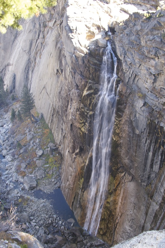
So, this might be the only part where we didn’t exactly follow Muir’s instructions. We went to an overlook before reaching Illilouette Falls, which I would call the most dangerous waterfall overlook I’ve ever seen. It looked like there used to be a railing, but it’s long gone. The only way to see the very bottom of the falls is to stand dangerously close to the edge of the cliff. This time of year (with no water in Yosemite Falls), Illilouette Falls was quite impressive.

“Thence returning to the trail follow it to the head of the Nevada Fall. Linger here an hour or two for not only have you glorious views of the wonderful fall, but of its wild, leaping, exulting rapids and, greater than all, the stupendous scenery into the heart of which the white passionate river goes wildly thundering, surpassing everything of its kind in the world. After an unmeasured hour or so of this glory, all your body aglow, nerve currents flashing through you never before felt, go to the top of the Liberty Cap, only a glad saunter now that your legs as well as head and heart are awake and rejoicing with everything.”
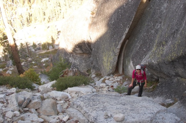
Okay, so this might be another place where we didn’t quite capture the true spirit of Muir’s hike. Our “unmeasured hour” lasted about 30 seconds. There were many people basking in the sun, but it was already 2 o’clock and we didn’t want to spend too much time walking in the dark. We weren’t sure if it was a good idea to keep going. After some thought, we conceded that we had enough time to go up and down Liberty Cap. We had headlamps so there was no excuse to cut the hike short at this point. We crossed the bridge and headed towards Little Yosemite Valley and the use trail up Liberty Cap. According to John Muir, Liberty Cap should just be a “glad saunter” by now. It was a relatively short distance but a difficult climb of over 1000-ft.
“The Liberty Cap, a companion of the Half Dome, is sheer and inaccessible on three of its sides but on the east a gentle ice burnished juniper-dotted slope extends to the summit where other wonderful views are displayed where all are wonderful: the south side and shoulders of Half Dome, and Clouds Rest, the beautiful Little Yosemite Valley and its many domes, the Starr King cluster of domes, Sentinel Dome, Glacier Point, and, perhaps the most tremendously impressive of all, the views of the hopper-shaped canõn of the river from the head of the Nevada Fall to the head of the Valley.”
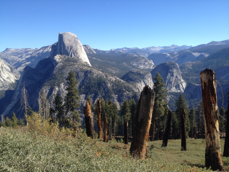
From Nevada Fall, we followed the trail towards LYV for only about a half mile. A short distance past some restrooms, the trail reaches a high point. A small wash splits off to the left (towards Liberty Cap). Assuming we didn’t want to go downhill, we followed the wash, which soon turned into half a dozen small use trails heading up the side of the dome.
The slope up the side of Liberty Cap is mostly a class 2 scramble, with only a couple short sections that might be considered class 3 climbing (with your hands). The initial climb away from the trail is about as steep as it gets. We headed for the shoulder beneath Liberty Cap. Half Dome loomed in front of us. Once on the shoulder, we turned left and made our way up a boulder-strewn notch towards the top.
The crux of the climb is about halfway up the dome itself, you will find yourself needing to step up onto a steep boulder. A quick and not-too-risky move and you’re free to hike the rest of the way up the notch, all the way to the summit. This climb is definitely worth it – I’m surprised more people don’t come up here. This is a great alternative to hiking Half Dome.

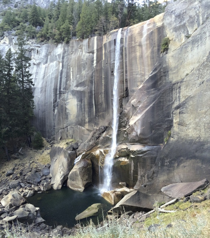
“Returning to the trail you descend between the Nevada Fall and the Liberty Cap with fine side views of both the fall and the rock, pass on through clouds of spray and along the rapids to the head of the Vernal Fall, about a mile below the Nevada. Linger here if night is still distant, for views of this favorite fall and the stupendous rock scenery about it. Then descend a stairway by its side, follow a dim trail through its spray, and a plain one along the border of the boulder dashed rapids and so back to the wide, tranquil Valley.”
After a long break, we made our way down Liberty Cap and headed for the Mist Trail. In October, there’s only about eight cubic feet per second of water flowing at Happy Isles. The waterfalls are nice but not quite as impressive as in the spring.

We left the head of Nevada Falls at 4:35pm and made it down to the Valley at 6:18pm – perfect timing to catch the shuttle bus. A total of twelve and a half hours of hiking for this twenty mile hike. John Muir, we have differing opinions on what one should do if one was so time poor as to have only one day in Yosemite. Then again, maybe not – it was a great day. It was the hardest day hike I’ve ever done, but it was also the most spectacular.


More Info: The book The Yosemite by John Muir is available as html for free from Sierra Club, or free from Amazon (Kindle version), or free from Google Books (EPUB, PDF).
Muir’s time, there were no cables up Half Dome. Or the trail to Clouds Rest. Although he did Dana in a day or two from the Valley. Some guy in the 1930’s did Lyell and back in a day from the Valley, too. Once I wished to bag it in a day climb from TM, but no takers. Neither for another ski. Christa’s not getting a divorce, sounds good.
Yeah, I get the impression that Muir did some really long miles. Would have been even harder in his time without an abundance of high energy hiking foods. Also in his time the four mile trail was actually only four miles. In any case, this didn’t seem like a trip for the masses, unless it was supposed to be on horseback.
I was fortunate enough to spend sometime in the park just 4 weeks ago, i shot a short film showcasing some of it. Can’t wait to return.
Beautiful, thanks for sharing! It’s a roar with all the water in Spring but it’s very quiet with less water and visitors in the fall, and that feeling is well captured in the video. Love the time lapse!
Thanks, too J! One of the coolest videos I’ve seen on Y. Wish that I had the time and energy for such polish. I seek though to get stuff online right away, as today on my bus trip up I-80 yesterday. Pretty rough, but looks real. On TV just now, they showed that you can’t “believe anything,” with Photoshop and CGI. Nice to see no lawsuit, I guess, from any of those hikers as you can see who they are, by me.
btw, hiked Sentinel yesterday, though missed Liberty Cap today, took too much time on the Mist Trail. 2,000′ gain is my speed nowadays. Going to have nice video, too, but rough/handheld w some time lapse. Online at PTP come hopefully Friday and later.