We had big plans for hiking in Yosemite (on the order of twenty miles or so), but the summer heat defeated those plans. With little more than wet rocks in place of raging waterfalls, I wanted to go on a hike away from the crowds, and with a little bit of history. This hike fit that bill perfectly, even if it was a bit ad-lib.
History: The Wawona Road into Yosemite Valley was completed in 1875, but the Coulterville Road and the Big Oak Flat Road were completed in 1874. All three were toll roads, and for twenty five years they competed for stagecoach traffic into Yosemite Valley. The Wawona Road had the advantage of offering the greatest views of the valley, as well as being en route from the Mariposa Grove of Big Trees. The first automobile to enter Yosemite Valley was in June 1900, and it was Oliver Lippincott who came along the Wawona Road in a steam-powered auto. He traveled from the Wawona Hotel to the Valley in just three hours, a trip that took the stage coaches a very dusty twelve hours. In 1903 President “Teddy” Roosevelt came into Yosemite with John Muir from the Wawona Road and exited the park on the Coulterville Road. This visit was instrumental in the expansion of Yosemite National Park boundaries.
By 1927, plans were formed to upgrade the Wawona Road. Construction of the new route began in 1928. It was deemed that the grade from Inspiration Point down to Bridalveil Falls was too steep so a lower route was surveyed. In order to prevent an “irremediable scar” on the bluffs of Turtleback Dome, the Wawona Tunnel was proposed. The idea was met with opposition; some hoped to save Inspiration Point as a roadside feature, but ultimately the tunnel idea prevailed and Inspiration Point was bypassed by the new road.
Construction on the Wawona Tunnel began in 1930 and the first auto passed through in January 1932, but it was not formally completed until June 10th, 1933. Discovery View, or Tunnel View as it’s now called, was created at the base of the tunnel to replace the vista point of the old road – Inspiration Point. The Old Wawona Road remained open to cars from Bridalveil Fall up to Inspiration Point, until it was damaged by the flood of 1937. Since that time, for 75 years, the road has seen the slow decay of time, but it’s still more or less intact today.
Directions to Trailhead: The trail begins at Tunnel View on the Wawona Road. When entering Yosemite Valley from the southern park entrance on Highway 41, Tunnel View is comprised of two parking lots immediately after the long Wawona Tunnel. Cool fact: the Wawona Tunnel is the longest tunnel in California!
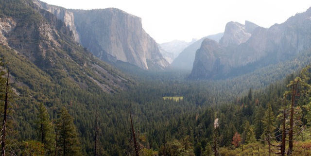
Trail Description: While parked at the trailhead, I was quite pleased to discover that our CA “Special Interest License Plate” for Yosemite, actually depicts the view from Tunnel View. Took a few pictures of our car with the view.
There are bear boxes at the trailhead in the Tunnel View parking lot, and it would be wise to use them, even if you think that a bear would want nothing to do with the tour busses and crowds of people snapping photos. The trail begins immediately with switchbacks heading up the side of the mountain. After about a mile, it crosses the Old Wawona Road, which does not look paved for this section, but it’s hard to miss.

Above the Old Wawona Road, the trail continues switching back and forth. The trees begin to thin slightly and one can catch some incredible views of Yosemite Valley, so it’s best not to walk with too much haste (it’s also pretty steep). In fact, the best views of this hike are a little before the highest point of the trail.

When the trail reaches a large flat area with some paved sections, you’ve reached your destination, though there are not really any signs or placards as you might expect in the third most visited National Park. By following the road to the west, one can walk along the area known as Inspiration Point. I think the past seventy-five years have seen some vegetative growth, because I found it quite difficult to gain inspiration from this vantage point. Maybe next time I’ll have to go up the Pohono Trail all the way to Old Inspiration Point (an even older vista point from a time when there were no roads).
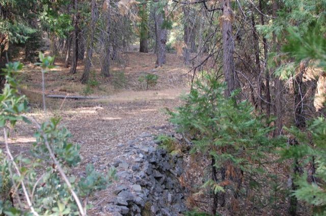
On a whim, I decided it would be fun to take the Old Wawona Road back down, by continuing west down the paved road. Numerous trees have fallen over the path, as well as rock slides, but the way is very obvious, well constructed and nicely graded. You can see stone retaining walls and other road construction remnants, as well as bear scat. After about a half mile down, a grand vista is seen, overlooking the Merced river canyon and the highway below. As the road continues down the mountain, with a couple of switch backs, you can actually also see hints of the old Big Oak Flat road across the valley. The old Big Oak Flat has some interesting history, but I’ll save that one for a later date.


After a couple miles of walking down from Inspiration Point, you’ll meet back up with the trail where you had crossed the road on the way up. You could head back down from here, but you’d be missing out on Artist Point.
Artist Point is about a half mile down the Old Wawona Road, or about 1.5 miles up the road if you left from the Bridalveil Fall parking lot. We saw a bear on the way down – it’s nice to know that the road is still used by some. It ran away from us very quickly. You’ll know you’re at Artist Point when you’re in a big exposed rock outcropping, and/or you see the USGS benchmark placed in 1906.


It may not be the most thrilling or challenging hike in Yosemite Valley, but it was fun to enjoy great views of the valley without any of the crowds, on a weekend nonetheless.
More Info: The Old Wawona Road doesn’t seem to show up on any maps except for the old USGS Topo maps from 1897 and 1909, which you can download here. Most of the information about the construction of the road was garnered from the Historic American Engineering Record (HAER No. CA-148).

Great article. We were in Yosemite from September 14-16, 2017. We hiked to Artist Point on 9/14. Awesome views and no one was there! https://www.facebook.com/photo.php?fbid=10155699779513996&set=t.642408995&type=3&theater